Explore Latvia · Nature
Nature in Latvia: walks, trails and landscapes
Latvia offers raised bogs, wooded river valleys, dune forests, lakes and a long Baltic coast, but the easiest outing depends on the trailhead rather than the landscape name. This guide compares real routes, realistic bases and the final connection from town or station.
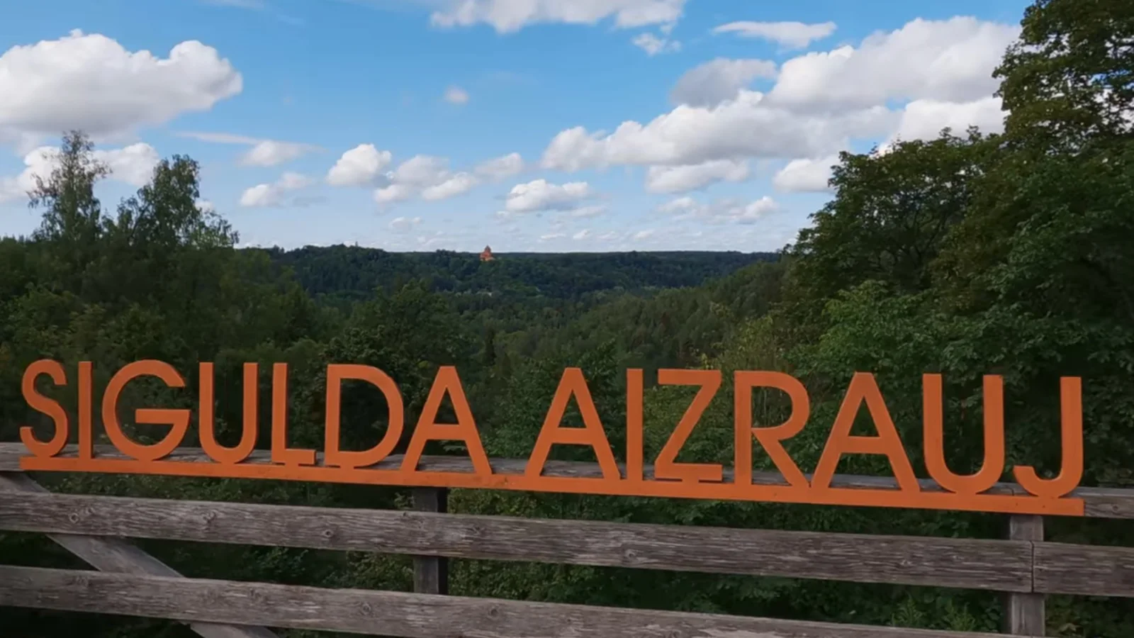
- Easiest car-free base
- Sigulda
- Best-known bog walk
- Great Ķemeri Boardwalk, 1.5 km or 3.5 km
- Accessible short boardwalk
- Black Alder Swamp Boardwalk, 500 m
- Best slow coast route
- Slītere and Cape Kolka
- Best eastern base
- Rēzekne for the Rāzna area
This guide is independently written and checked against conservation authorities, transport operators and municipal or regional trail information.
Confirm the trail, surface and return
Open the official route page before departure, then check the weather, daylight, current restrictions and the complete return connection. Trail surfaces and seasonal services can change.
Choose the outing before the region
For the simplest car-free nature day, start with Sigulda or Ķemeri. Cēsis works when you allow for the connection to Cīrulīši. Slītere and Rāzna reward an overnight regional base because their trailheads are scattered and public transport does not join every useful stop.
Distance alone does not describe difficulty. Gauja routes involve stairs and steep valley slopes, while short bog boardwalks can be narrow or slippery. The accessible examples on this page have firmer, wider surfaces, but visitors should still confirm current conditions and the complete route from the arrival stop.
Sources: Sigulda Tourism: Turaida ravines and caves route , Cēsis Tourism: Cīrulīši nature trails , Jūrmala Tourism: Great Ķemeri Bog Boardwalk , Jūrmala Tourism: Black Alder Swamp Boardwalk , Kurzeme nature trails guide: Pēterezers and Cape Kolka , Ventspils Tourism: Būšnieku Lake Nature Trail
Latvia nature walks compared
Times below describe the visit from the stated base or access point, not the journey from Riga. Difficulty is an editorial comparison of published distance, surface and terrain. Weather, maintenance and seasonal restrictions can change the practical level.
| Landscape | Best base | Signature visitor experience | Easiest access | Car-free suitability | Typical time needed | Walking difficulty | Best season | Weather alternative |
|---|---|---|---|---|---|---|---|---|
| Gauja Valley at Sigulda | Sigulda | Turaida ravines and caves, 6 km | Start near Turaida; local transport or a planned valley circuit | Very good to Sigulda; local hills still require planning | 2-3 hours for the route; half to full day with sights | Moderate: steep ravines and stairs | April-October; dry winter days only when paths are safe | Sigulda castle quarter or Turaida Museum Reserve |
| Gauja Valley at Cēsis | Cēsis | Cīrulīši nature trails, 3.5 km or 6.2 km | Reach Cēsis, then continue to the Cīrulīši trail area | Good, with a final local connection or added walk | 1.5-3 hours; allow a half day from central Cēsis | Easy on published routes; forest and boardwalk surfaces | April-October; year-round only for suitable conditions | Cēsis castle and museum area |
| Ķemeri raised bog | Ķemeri or Jūrmala | Great Ķemeri Bog Boardwalk, 1.5 km or 3.5 km | Trail parking; summer 2026 express bus; otherwise a long approach from Ķemeri station | Moderate; the rail journey is easy but the trailhead is not beside the station | 1-1.5 hours on the boardwalk; half day including access | Easy walking, but narrow, unrailed and slippery when wet | May-September; open year-round when surfaces are safe | Black Alder boardwalk or an indoor Jūrmala stop |
| Ķemeri wet forest | Ķemeri | Black Alder Swamp Boardwalk, 500 m | Meža māja parking or local bus; 2.5 km walk from Ķemeri station | Good if the approach distance is manageable | About 30 minutes on the trail; 1.5-3 hours with access | Easy; wheelchair and pushchair suitable boardwalk | Year-round, with care on wet or snowy timber | Ķemeri park and visitor facilities when open |
| Slītere dune forest | Mazirbe, Dundaga or Kolka | Pēterezers trail, 3.5 km | Roadside trailhead on the P125; car is simplest | Poor: no public transport at the trailhead | About 1 hour on the published loop; allow a regional half day | Moderate: stairs, short steep sections and boardwalk | Late spring-early autumn | Dundaga or Ventspils cultural sights |
| Slītere coast and Cape Kolka | Kolka | Cape Kolka plus the 1.8 km pine trail | Drive to Cape Kolka or use a regional bus to Kolka and allow the final approach | Moderate with timetable planning | 2-3 hours locally; usually an overnight coastal route from Riga | Easy trail; sand, boardwalk and optional tower climb | May-September; bird-migration periods suit patient observers | Livonian Coast heritage stops or a shorter village visit |
| Rāzna lakes and hills | Rēzekne or Lūznava | Lake views and the stair path up Mākoņkalns | Car or pre-arranged local transfer from the regional base | Limited for a multi-stop day without a car | Full day; one or two nights for a broader Latgale route | Moderate: steps and hill ascent; other stops vary | May-October | Lūznava Manor or Rēzekne museums and concert venues |
| Lake and forest near Ventspils | Ventspils | Būšnieku Lake loop, 8 km, with a 187 m accessible boardwalk | Boat-base parking or a planned local connection from Ventspils | Moderate from a city base | About 3 hours for the loop; shorter for the viewing boardwalk | Easy on maintained compacted and timber surfaces | April-October; shorter visits in suitable winter conditions | VIZIUM or Ventspils Livonian Order Castle |
Sources: Sigulda Tourism: Turaida ravines and caves route , Cēsis Tourism: Cīrulīši nature trails , Jūrmala Tourism: Great Ķemeri Bog Boardwalk , Jūrmala Tourism: 2026 nature express bus , Jūrmala Tourism: Black Alder Swamp Boardwalk , Kurzeme nature trails guide: Pēterezers and Cape Kolka , Nature Conservation Agency: Rāzna National Park , Latgale Tourism: Mākoņkalns , Ventspils Tourism: Būšnieku Lake Nature Trail
Ķemeri: choose the boardwalk and the access point
The Great Ķemeri Bog Boardwalk has a 1.5 km short loop and a 3.5 km long loop with an observation tower. The official visitor page allows about one hour for the short loop and 1.5 hours for the long loop. The timber is unrailed, is not wheelchair suitable and can become slippery in rain; snow is not cleared in winter.
Ķemeri railway station is not at the boardwalk entrance. The published walking approach continues from the station to the A10 area, along the access road and then from the parking area to the boardwalk. From 1 June to 31 August 2026, Jūrmala express bus 5 serves a Ķemeri Boardwalk stop, but the trail begins about 2 km from that stop. Recheck the timetable before relying on this seasonal service.
For a shorter accessible nature stop, use the 500 m Black Alder Swamp Boardwalk at Meža māja. Jūrmala describes it as suitable for wheelchairs and pushchairs, with a 120 cm-wide boardwalk and handrails. The station approach is about 2.5 km, so accessible transport must be planned separately.
Best first bog view
Use the Great Ķemeri long loop when the surface and weather are suitable.
Best short accessible trail
Use the Black Alder boardwalk, then confirm the route to Meža māja and seasonal toilet availability.
Avoid a false car-free assumption
A train to Ķemeri solves the intercity leg, not the full trailhead connection.
Open guideSources: Jūrmala Tourism: Great Ķemeri Bog Boardwalk , Jūrmala Tourism: 2026 nature express bus , Jūrmala Tourism: Black Alder Swamp Boardwalk , Vivi: passenger information and timetables
Gauja Valley walks from Sigulda
Sigulda is the easiest Gauja base because trains reach the town and several routes combine landscape with castles or museum visits. The official Turaida ravines and caves route is 6 km, takes about 2-3 hours and is graded moderate. It uses steep ravines and valley terrain, so it is not equivalent to a flat town walk.
A larger Sigulda circuit can cross the Gauja valley and involve prolonged climbs. Choose a route that starts and finishes at places you can actually reach, and decide before departure whether a cable car, local bus or taxi forms part of the circuit.
For a first half day
Combine one moderate valley route with either the Sigulda castle quarter or Turaida, not every viewpoint on the same walk.
Open guideFor wet or icy conditions
Reduce the valley section and keep the cultural stop. Stairs, roots and sandstone-side paths deserve more caution than the distance suggests.
Sources: Sigulda Tourism: Turaida ravines and caves route , Nature Conservation Agency: Gauja National Park , Vivi: passenger information and timetables
Gauja walks from Cēsis
Cēsis is another rail-connected base, but the medieval centre and the nature trailhead are separate places. The official Cīrulīši route material lists 3.5 km and 6.2 km nature-trail options, plus a 2.7 km health trail. The nature routes use gravel roads, forest paths and boardwalks and are graded easy.
Allow time for the final connection from central Cēsis to Cīrulīši and for the return. Travellers who want a demanding full-day hike can find longer routes in the park, but the shorter marked loops are more reliable for a first visit or a mixed town-and-nature day.
Short nature block
Choose the 3.5 km Cīrulīši option and preserve time for the historic centre.
Open guideLonger walk
Use the 6.2 km option only after checking the route map, daylight and the return connection.
Sources: Cēsis Tourism: Cīrulīši nature trails , Nature Conservation Agency: Gauja National Park , Vivi: passenger information and timetables
Slītere: dune forest, coast and Cape Kolka
Slītere is not one compact attraction. Its forest, former shoreline formations, coastal villages and Cape Kolka are spread across north-west Kurzeme. A car or a local overnight base makes it far easier to join more than one stop.
The 3.5 km Pēterezers loop crosses sandy dune ridges and wet hollows using forest path, stairs and boardwalk. The trail brochure lists about one hour and states that there is no public transport at the trailhead. A few steep sections and long stairs make the route moderate despite the short distance.
Near Cape Kolka, the 1.8 km pine trail is an easier introduction to dune forest and coast. The published route includes boardwalk, sand, viewing platforms and an optional tower. Regional buses can reach Kolka, but frequency and the final walk require an exact-date check.
One local outing
Choose Cape Kolka and the pine trail when staying in Kolka.
One forest outing
Choose Pēterezers only when transport to and from the roadside trailhead is settled.
Best route shape
Stay on the Kurzeme coast rather than attempting a rushed return from Riga.
Open guideSources: Nature Conservation Agency: Slītere National Park , Kurzeme nature trails guide: Pēterezers and Cape Kolka , Road Transport Administration: Public Transport Division
Rāzna: lake country needs a regional plan
Rāzna National Park is a broad Latgale landscape rather than a single signed circuit. Rēzekne provides the most practical transport and service base, while Lūznava works well within a road itinerary. The lake, Mākoņkalns, Lielais Liepukalns and cultural stops are separated enough that a multi-stop day is much easier with a car or pre-arranged transfer.
Mākoņkalns offers a defined short ascent by steps to the hilltop and castle ruins, with views towards Lake Rāzna. It is a useful named stop, but it should not be presented as representative of the accessibility of the wider park.
Without a car
Use Rēzekne as the base and arrange one realistic lake or hill excursion rather than several uncertain connections.
Open guideWith a car
Allow a full day for the park and keep Lūznava Manor as a weather alternative.
For a slower trip
Stay one or two nights in Latgale so the day is not dominated by the return to Riga.
Open guideSources: Nature Conservation Agency: Rāzna National Park , Latgale Tourism: Mākoņkalns , Rēzekne Tourism: regional visitor guide
Selected accessible nature trails
An accessible trail description applies to the named path, not automatically to the journey, toilet, car park, viewing tower or public-transport connection. Confirm the full visit with the local operator if a step-free route is essential.
Black Alder Swamp Boardwalk, Ķemeri
A 500 m boardwalk described as suitable for wheelchair users and pushchairs. It has handrails and a published width of 120 cm; timber can be slippery or snowy.
Būšnieku Lake Nature Trail, Ventspils
An 8 km maintained route described as accessible to wheelchair users, with compacted surfaces and a 187 m timber walkway to a bird-viewing platform.
Open guideCape Kolka pine trail
The viewing platforms can be reached, but the trail brochure says the complete route is not fully accessible. Sand and the optional tower change the experience.
Sources: Jūrmala Tourism: Black Alder Swamp Boardwalk , Ventspils Tourism: Būšnieku Lake Nature Trail , Ventspils Tourism: environmental accessibility , Kurzeme nature trails guide: Pēterezers and Cape Kolka
Nature without a car
Build the day in three parts: the intercity service, the last connection to the trailhead and the return after the walk. Check all three before buying a timed attraction ticket or committing to an evening train.
Strongest rail bases
Sigulda, Cēsis and Ķemeri. Each still requires a route-specific last-mile check.
Useful city base
Ventspils gives access to maintained urban and lakeside nature, although a local connection may still be needed.
Bus-dependent coast
Kolka can work with regional buses when the exact outward and return services fit. Pēterezers does not have a public-transport trailhead.
Hardest multi-stop region
Rāzna is possible as a planned excursion, but scattered nature stops are not a simple hop-on route.
Sources: Vivi: passenger information and timetables , Road Transport Administration: Public Transport Division , Jūrmala Tourism: 2026 nature express bus , Kurzeme nature trails guide: Pēterezers and Cape Kolka
Check surfaces, weather and protected-area rules
Wooden boardwalks can be slippery after rain and may not be cleared in winter. Gauja paths add exposed roots, steps and steep slopes. Coastal wind can make a short Cape Kolka visit colder and less comfortable than the temperature in Riga suggests.
Before departure, open the official area or trail page, check the forecast and confirm any closure or seasonal restriction. Follow local signs, remain on required routes, keep distance from wildlife and take all litter away. Do not assume that fires, camping, drones or dogs are permitted everywhere in a protected area.
Carry offline route details
Save the map, trailhead and return stop before leaving town.
Turn back early
A flooded, icy or damaged surface is a reason to shorten the route, not to improvise beside the boardwalk.
Keep a weather alternative
Pair nature with a nearby castle, museum, manor or visitor centre rather than losing the whole day.
Sources: Nature Conservation Agency: protected areas , LVĢMC: Latvian populated-place forecasts , Jūrmala Tourism: Great Ķemeri Bog Boardwalk , Jūrmala Tourism: Black Alder Swamp Boardwalk
Nature trip questions
What is the easiest nature day trip from Riga without a car?
Sigulda is the simplest all-round choice because the train reaches the town and nature can be combined with castles. Ķemeri is also possible, but the Great Bog Boardwalk is not beside the railway station.
How long is the Great Ķemeri Bog Boardwalk?
The official visitor page lists a 1.5 km short loop and a 3.5 km long loop. Allow about one hour or 1.5 hours respectively, plus the journey to the trailhead.
Is the Great Ķemeri Bog Boardwalk wheelchair accessible?
No. Jūrmala states that it is not suitable for wheelchair users and has no rail. The nearby 500 m Black Alder Swamp Boardwalk is the better accessible example.
Can Cape Kolka be visited without a car?
Yes when a regional bus timetable works for the exact date. Allow for the final local walk and do not assume that buses are frequent enough for an improvised day trip.
Where should I stay for Rāzna National Park?
Rēzekne is the practical transport and service base. Lūznava or rural accommodation can reduce driving inside the region when you already have local transport arranged.
Which Latvia nature trails are suitable for wheelchair users?
The Black Alder Swamp Boardwalk and Būšnieku Lake Nature Trail are described by their local visitor authorities as accessible. Confirm the approach, current surface, facilities and any assistance required before travel.
Sources: Sigulda Tourism: Turaida ravines and caves route , Jūrmala Tourism: Great Ķemeri Bog Boardwalk , Jūrmala Tourism: Black Alder Swamp Boardwalk , Kurzeme nature trails guide: Pēterezers and Cape Kolka , Nature Conservation Agency: Rāzna National Park , Ventspils Tourism: Būšnieku Lake Nature Trail
Check the primary information
Official sources and review information
This guide was last reviewed on 27 July 2026. Conservation authorities support the protected-area guidance. Municipal and regional route pages support the named distances, surfaces and accessibility details, while transport operators support the access planning.
Nature protection
Nature Conservation Agency: protected areas
Official protected-area categories, current visitor information and conservation context.
Gauja National Park
Nature Conservation Agency: Gauja National Park
Official park scope, landscape and protected-area context.
Sigulda Tourism: Turaida ravines and caves route
Official local route distance, duration, difficulty and recommended season.
Cēsis Tourism: Cīrulīši nature trails
Official route options, surface, difficulty and year-round visitor context.
Ķemeri National Park
Jūrmala Tourism: Great Ķemeri Bog Boardwalk
Official route lengths, durations, surface, accessibility, facilities and trailhead directions.
Ķemeri access
Jūrmala Tourism: 2026 nature express bus
Official 1 June to 31 August 2026 operating period and distance from the boardwalk stop to the trail.
Accessible trails
Jūrmala Tourism: Black Alder Swamp Boardwalk
Official length, duration, accessible design, surface and public-transport approach.
Slītere National Park
Nature Conservation Agency: Slītere National Park
Official national-park scope, coastal habitats and protected-area context.
Kurzeme nature trails guide: Pēterezers and Cape Kolka
Municipal and Nature Conservation Agency route guide covering distances, surfaces, access, difficulty and accessibility.
Rāzna National Park
Nature Conservation Agency: Rāzna National Park
Official national-park scope, lake landscape and protected-area context.
Latgale Tourism: Mākoņkalns
Regional destination source for the stair path, hilltop ruins and Rāzna views.
Latgale access
Rēzekne Tourism: regional visitor guide
Municipal visitor context for Rēzekne as a base and the main Rāzna-area stops.
Accessible trails
Ventspils Tourism: Būšnieku Lake Nature Trail
Municipal route length, walking time, accessible surfaces and viewing-boardwalk details.
Ventspils Tourism: environmental accessibility
Municipal accessibility information for the Būšnieku route, parking, Braille and audio information.
Public transport
Vivi: passenger information and timetables
Official rail journey search and service updates for Sigulda, Cēsis and Ķemeri access.
Road Transport Administration: Public Transport Division
Official responsibility and information for regional bus and rail services.
Weather
LVĢMC: Latvian populated-place forecasts
Official current forecast data used for pre-walk weather checks.
Continue planning